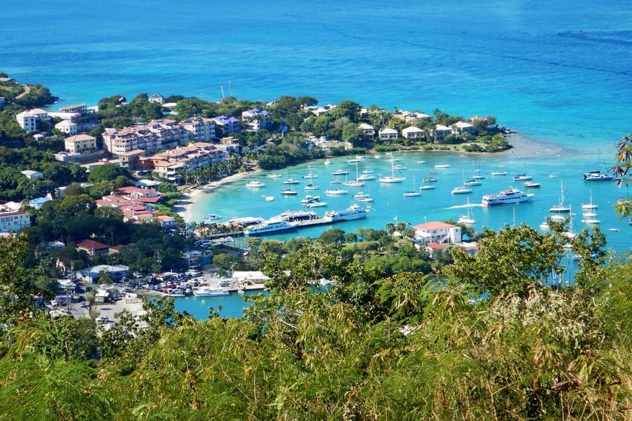
St John’s Caneel Hill Trail begins in Cruz Bay, about twenty yards past the Mongoose Junction parking lot, and rises to the summit of Caneel Hill. The trail then descends, running along the ridgeline to the saddle, or low point, between Caneel Hill and the next mountain peak, Margaret Hill.
From the saddle, the trail leads to the top of Margaret Hill, from where it descends the northern face of the mountain arriving at the North Shore Road just across from the entrance to the Caneel Bay Resort. The total distance is 2.4 miles.
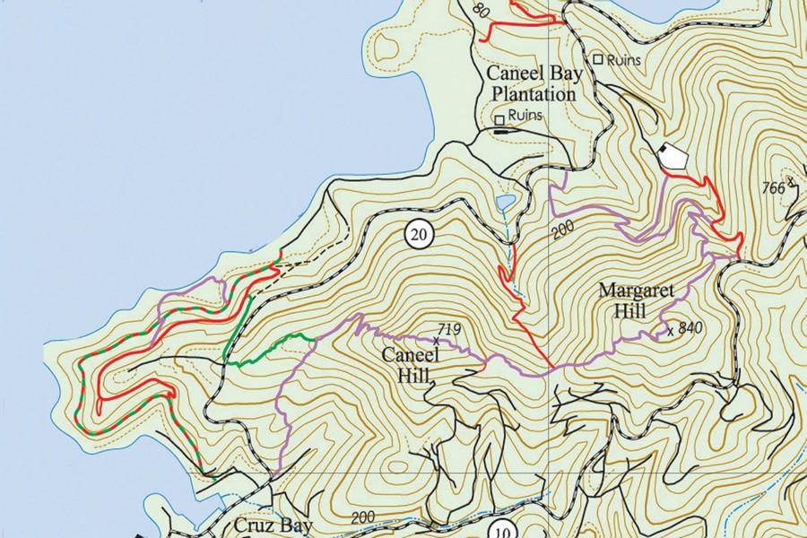
Difficulty: Be prepared. The trail to the peak of Caneel Hill is a steep and steady incline, gaining 719 feet of elevation in less than one mile. So its difficulty is a bit above normal.
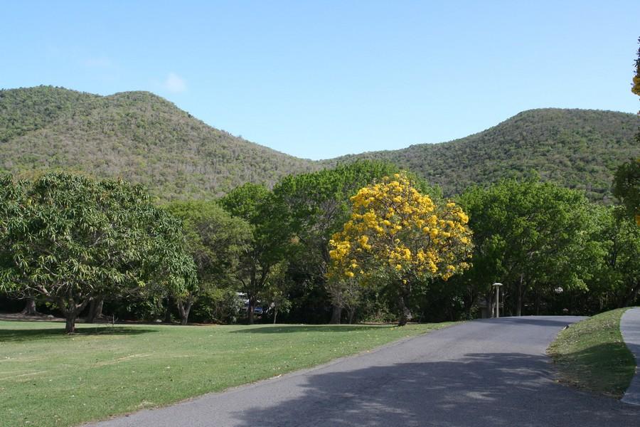
Environment: The trail passes through typical dry forest terrain in an area once dedicated to the cultivation of cotton. In the late nineteenth century, the cotton plantations were sold or abandoned, and the land was used primarily for pasture and for the cultivation of small provision garden plots until its acquisition by the National Park in the 1950s.
Mongoose Junction to the Caneel Hill Spur
About a third of the way up the trail (0.3 mile), you will come to the intersection of the Caneel Hill Spur Trail, which will be to the left, running downhill. The spur trail eventually crosses the North Shore Road and then continues on to meet the Lind Point Trail.
Continuing up the Caneel Hill Trail
At the spur intersection, remain on the Caneel Hill Trail, which continues to the right and uphill. A bench near the top of the trail will provide a welcome location to stop and rest and enjoy the spectacular northerly views.
From the bench, it’s just about 100 yards further to the top of Caneel Hill.

Caneel Hill Summit
At the peak of Caneel Hill, you will be treated to a magnificent panorama. Before Hurricane Hugo hit St. John and the rest of the U.S Virgin Islands, there was a wooden viewing tower atop Caneel Hill, which provided a magnificent panoramic view. The hurricane destroyed the structure, but at least the bench where one could sit and rest at the end of the strenuous climb still remains intact.
For many years the National Park, for whatever reason, had not seen fit to repair or replace the tower, but some 20 years later, a St. John resident, Frank Cummings, who operates SNUBA, decided to do something about it.
With some persistence, he was able to obtain both permission and partial funding from the National Park to construct a new tower atop the 719-foot-high hilltop. Work began in May of 2006 with the help of private volunteers the project is now complete.
Additional funding was provided by Steve Black. Eric Bauman helped bring up some of the 80-pound bags of cement, teachers from the Baptist school brought up a generator, and Boy Scouts from Illinois helped bring up lumber, as did volunteers from Friends of the Park.
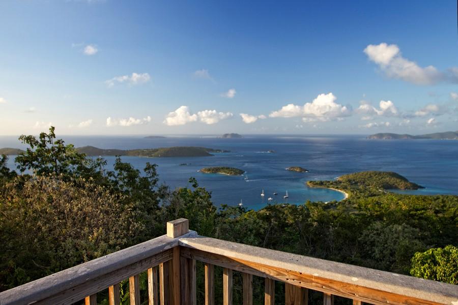
From this vantage point, you can see a great deal of the Virgin Islands archipelago, and on clear days you may even be able to see as far as the mountainous El Yunque rainforest in Puerto Rico.
From Caneel Hill to the Saddle
From the summit of Caneel Hill, the trail continues to the east toward Margaret Hill. The track at first follows the southern side of the ridge between the two mountain peaks offering spectacular views of the southwestern side of St. John.
It then crosses over the ridge and runs along the northern side of the mountain, from where you will enjoy views of the island’s north shore and beyond. The trail continues to descend until it reaches the saddle (lowest point on the ridge) between Caneel and Margaret Hills, where the trail once passed an old tamarind tree beneath which was a rustic wooden bench.
In 2006, it was discovered that this section of the trail went through private property, to remedy this, the Park moved this part of the trail some 50 yards to the north.
Tamarind Trail
This once abandoned Park trail was improved by local hikers and now is approved, and NPS maintained. The Tamarind Trail runs between the saddle and Route 20, just west of the Caneel Bay Resort.
From the Saddle to Caneel Bay
From the saddle, the trail ascends once again, taking you back into the pristine environment of the Park, following the mountain ridge to access the Margaret Hill Overlook and the summit of Margaret Hill Trail before descending once again to its eastern terminus at the North Shore Road at Caneel Bay.
Margaret Hill Ascent
The Margaret Hill Ascent of the Caneel Hill Trail begins at the entrance to the Caneel Bay Resort on the opposite side of North Shore Road. The trail ascends 840 feet in the course of a little over one mile to reach the summit of Margaret Hill. From here, it continues on to Caneel Hill and then down to Cruz Bay, near the Mongoose Junction parking lot.
From the Trailhead to the Water Catchment Spurs
The Margaret Hill ascent is shadier, cooler, and not as steep as the Caneel Hill ascent. As soon as you leave the paved roadway and enter the lush tropical forest, you cannot help but be overwhelmed by the serene natural beauty of your surroundings.
The trail rises gently, shaded by pepper cinnamon, guavaberry, and genip trees. A stand of teyer palm is said to be the only indigenous species of palm on St. John, lines a section of the trail. About 50 yards up the trail is a dry stacked native stone wall overgrown with anthuriums and strangler figs.
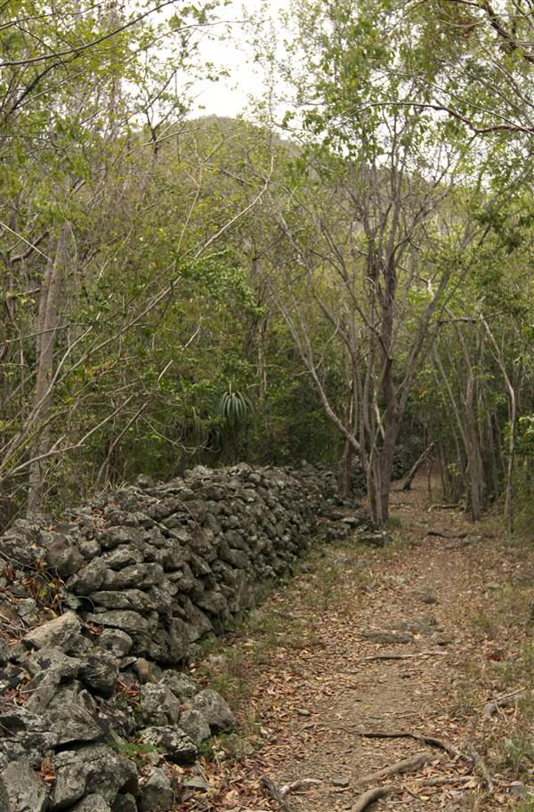
You may notice a point where the main trail seems to fork. A spur trail to the left, maintained periodically by local hikers, leads to the Water Catchment Trail. The Margaret Hill Trail continues steeply up the hill to your right.
As you gain elevation, views of the north shore and outer cays begin to open up through the foliage. This will be your signal to watch for a large triangular rock on the high side of the trail that is covered with beautiful native orchids.
After passing the area of native orchids, you will come to a switchback in the trail where there is another spur trail on the left leading to the Water Catchment Trail. Continuing on, you will come to a third trail intersection where there is a National Park Service directional sign. The path to the left leads to Centerline Road (Route 10) and the head of the Water Catchment Trail.
On to the Summit
Continuing along the Caneel Hill Trail, you will come to another large rock reminiscent of the orchid-covered one below. At this point, the trail becomes rather steep and rocky and leads to a scenic overlook with a view to the north. It’s only a few minutes’ walk from this overlook to the top of Margaret Hill.
Margaret Hill Overlook
When you reach the top of the hill, there is a nice view to the south, which unfortunately, is often obscured by foliage. But don’t fret, the really spectacular overlook lies about 50 yards further down the trail, where there is a spur to the left leading to a large rock outcropping. The spur is marked by a National Park Service sign. Climb up on the large flat rock and enjoy!
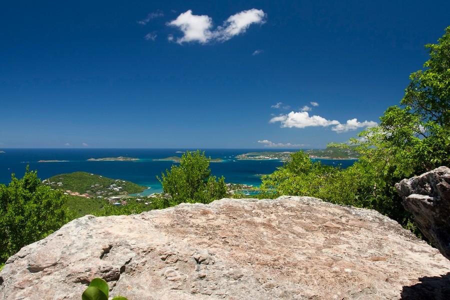
Shortcut to the Overlook
If all you want to do is get to the Margaret Hill Overlook and prefer not to take such a long hike, you can begin your walk at the entrance to the Water Catchment Trail at Centerline Road. Walk down to the spur trail. From there, it’s a much shorter walk to the overlook.
From the Margaret Hill Overlook, the trail continues to Caneel Hill and then runs back down to Cruz Bay near Mongoose Junction.
You can connect the two ends of the Caneel Hill Trail by using the Lind Point Trail to get back to where you began.
