The Lind Point Trail is a popular hike for travelers coming to St. John by ferry or those without a vehicle. That’s because the trail is within easy walking distance of downtown Cruz Bay.
It offers not only a great trail experience, such as the great views from the Lind Point Battery Overlook but also access to two beautiful beaches, Salomon Bay and Honeymoon Beach.

As the trail begins just a short walk from the ferry dock in downtown Cruz Bay, it’s ideal for day-trippers or cruise passengers who want to enjoy one of the best hikes the Virgin Islands National Park has to offer. You can also experience St. John’s world-famous north shore beaches without the necessity of renting a car or hiring a taxi.
Difficulty: Moderate
Distances
From the National Park Service Visitor Center to Honeymoon Beach (1.1 miles)
From the National Park Service Visitor Center to Salomon Bay (0.75 mile)
From the National Park Service Visitor Center to the Lind Point Overlook (0.4 mile)
Hiking Time: About 45 minutes (Cruz Bay to Honeymoon Beach if you take it slow)
Elevation
Sea level at Cruz Bay, Salomon, and Honeymoon Beach trailheads and 140 feet at the Lind Point Battery Overlook
Environment
The Lind Point Trail passes through the inland environments of cactus scrub between Cruz Bay and Lind Point and dry forest on the wooded slopes of Caneel Hill east of the point.
Lind Point Trail Route
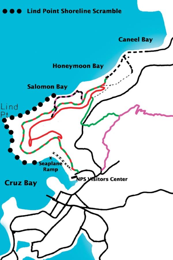
The hiking trail runs between the parking area behind the Virgin Islands National Park Visitor Center and Honeymoon Beach and Salomon Bay Beach. Hikers can enjoy unobstructed views of downtown Cruz Bay, the main harbor, and many of the islands and cays of Pillsbury Sound.
Cruz Bay to Lind Point
From the Cruz Bay trailhead, the trail passes through an area once known as Estate Lindholm, which in colonial days was dedicated to the cultivation of cotton. After crossing a dirt road, the trail rises gradually in elevation and follows the eastern shoreline of Cruz Bay.
Here the track is lined by tangles of night-blooming cereus, a cactus-like plant that once a year produces a magnificent white flower that opens at night and closes before sunrise the next morning. The flower is followed by the production of a delicious red fruit that tastes something like a kiwi.
About a quarter mile from the trailhead, the path splits into upper and lower branches. The upper trail will be to your right, while the lower trail will continue straight ahead.
Both trails access Salomon Bay and Honeymoon Beach, but only the upper trail passes by the Lind Point Battery Overlook.

Lower & Upper Trail
The lower trail is slightly shorter and less hilly than the upper trail and would be the preferred route for those who are not interested in the Cruz Bay overlook and are using the trail solely as a means of getting to Salomon Beach or Honeymoon beach.
The upper trail gains elevation through a series of switchbacks and then continues north toward Lind Point, the headland that defines the northern extremity of Cruz Bay and the northwestern corner of the island.
From Lind Point to Salomon Bay & Honeymoon Beach
When you get to Lind Point, a loop trail on your left leads to the overlook. From there, the trail turns right, or east, and follows the northwestern coastline through a dry forest environment.
Many of the rock formations along the hillsides are covered by epiphytes (air plants), such as bromeliads and anthuriums. Other rocks bear intricate designs created by lichen growing on the surface of the stones.
The Salomon Bay Spur Trail intersects both the upper and lower Lind Point trails about a quarter mile from Lind Point. For those going to Salomon Bay, take this trail down to the western end of Salomon Beach. The trail runs alongside the beach to the eastern end of Salomon Bay and then leads up to meet the lower Lind Point Trail.
For those not going to Salomon Beach, both the lower and upper part continues on toward Honeymoon Beach near a large tamarind tree. Cross over the dirt road to get to the beach. This road heads east towards the Caneel Bay Resort.
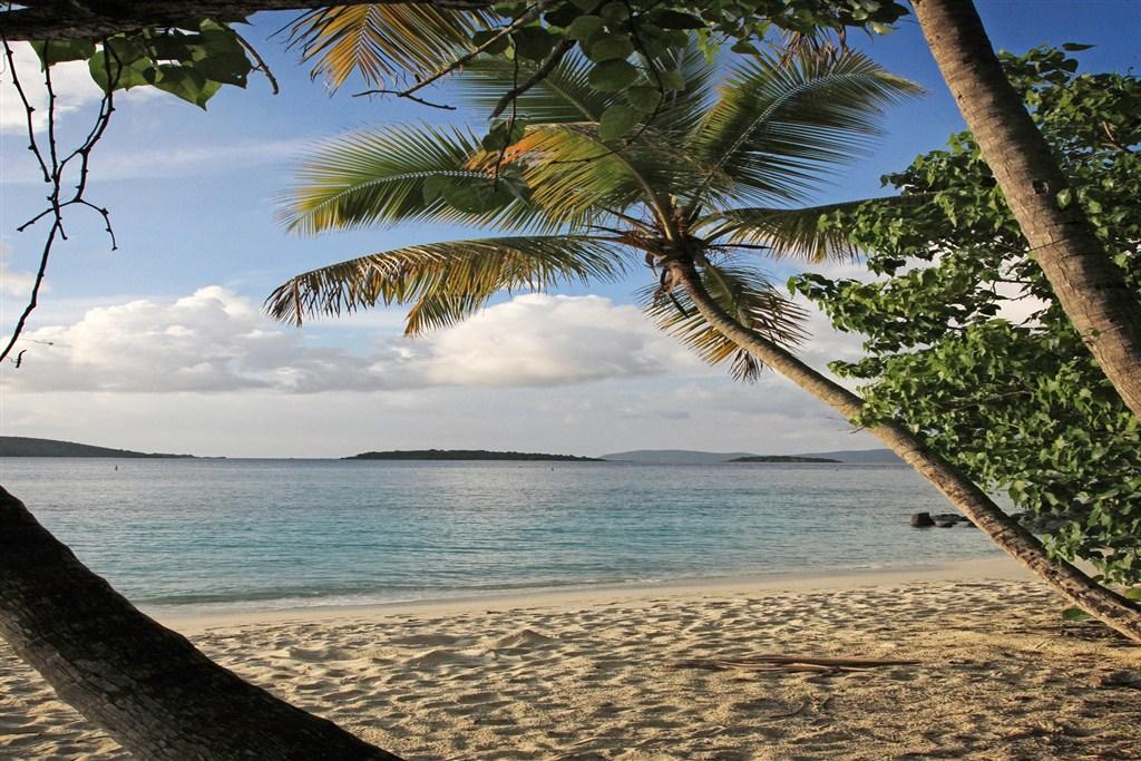
East of the Salomon Bay Spur Trail, the upper part of the trail intersects the Caneel Hill Spur Trail just before its intersection with the lower section.
Nearby Parking
Finding a place to park near the Lind Point Trail can be difficult, to say the least. Now the Virgin Islands National Park offers a solution of sorts. Hikers bound for the Lind Point Trail can go to the National Park Visitors Center located just across the street from the trailhead and obtain a parking permit that allows them to park in spaces reserved for the park employees.
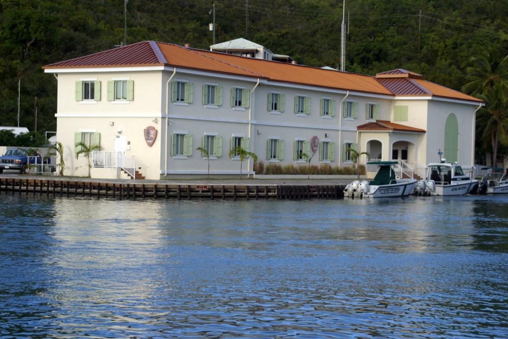
You’ll need to show the attendant at the center your driver’s license, which they will hold until you get back. They will then issue you a sign for you to place on your windshield. Be aware that empty employee parking spaces are limited and are often unavailable.
Parking anywhere else on the street will put you in danger of being ticketed by enforcement rangers. Park back wheels to the curb, windshield facing out towards the street, and enjoy your hike.
If arriving by boat, pick up a mooring and swim, snorkel, or dinghy to the beach. There is a special dinghy mooring line close to the beach, which you can use. Anchoring is forbidden.
Once on the beach, you’ll be able to rent beach chairs, lockers, snorkel gear, floats, kayaks, and paddle boards. The use of the hammocks and dining tables is complimentary. Bathrooms, showers, and changing rooms are also available.
Snacks and non-alcoholic beverages are for sale. You can bring your own beer and put it in the refrigerator.
