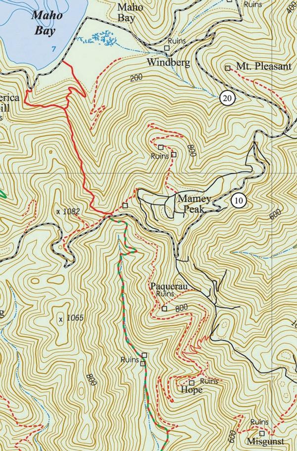
In the last few years, the Maria Hope Trail has become a popular hiking venue. Passing through shady, lush tropical forest, this old Danish Road provides Cinnamon Bay campers with convenient access to the Reef Bay Trail. There are historically significant ruins and a scenic overlook with bird’s eye views of Maho and Francis Bays and vistas extending eastward to West End Tortola and beyond.
The Maria Hope Trail follows an old Danish road that runs between the Josie Gut Estate on the Reef Bay Trail and Maho Bay on the north shore.

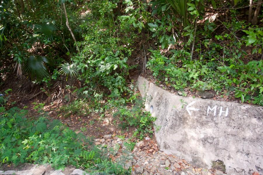
There have been some complaints, however, about the fact that the trail runs over private land at the lower elevations. There is now a cure for that. Down on the lower section, just before the wire fence that crosses the trail, there is a nice trail that switchbacks down the hill and comes out at Maho Beach, just east of the green building on the beach.
There is a road sign (West RT. 20) where it comes out. This new section of trail passes through the flats just inland from Maho Beach before it begins its steep uphill climb. The low-lying flats present a unique forested environment without thick or thorny undergrowth making it easy to pass through and enjoy.

From Centerline Road North to Maho Bay
From Centerline Road, enter the trail about 70 feet to the east of the Reef Bay Trail by the end of the guard rail. Just after you enter the woods, turn left and down.
The 0.8-mile track descends the western side of the Maho Bay Valley, following a gut, and emerging either on the North Shore Road at the end of the steep hairpin turn west of the beach at Maho Bay or on the flats behind the beach. The latter is the preferable route as, unlike the original road, this does not go through private property.
If you’re starting from the more difficult Maho Bay entrance, the trail begins by the West Route 20 road sign just east of the green building on the beach. (Use a GPS or the St. John Off the Beaten Track App)
At the top of the trail in the vicinity of Centerline Road, there are the remains of the old stone walls of a horse corral and the retaining wall for the original Danish Road, Konge Vey.
The trail passes through a beautiful tropical forest shaded by massive West Indian locust and hog plum trees, as well as attractive stands of bay rum and guavaberry.
The guava berry trees are rich with both purple and orange varieties of guava berries, prized for their use in wine and pastries. Also noteworthy are the beautiful rock formations, teyer palm, and heart leaf and scrub brush anthuriums.
From Centerline Road South to the Reef Bay Trail
From Centerline Road, the Maria Hope Trail follows the old Danish road through dry forest and leads back to the Reef Bay Trail just below the Josie Gut Estate.
Because of the enormous amount of fill used to create Centerline Road, access to the southern half of the Maria Hope Trail is extremely difficult at this original juncture. A spur trail, cut by a local hiking society, is found at the entrance to the Bordeaux Mountain Road.
Just east of the mailboxes provides difficult, although passable, access to the Maria Hope Trail. This is not an official Park trail, it is only semi-improved and is not regularly maintained. Be extremely careful. The trail is very steep and slippery.
The southern section of the Maria Hope Trail lies at the end of this spur. It is passable but with some difficulty, especially toward the bottom of the trail. Turn left. To the right, the trail ends just below Centerline Road.
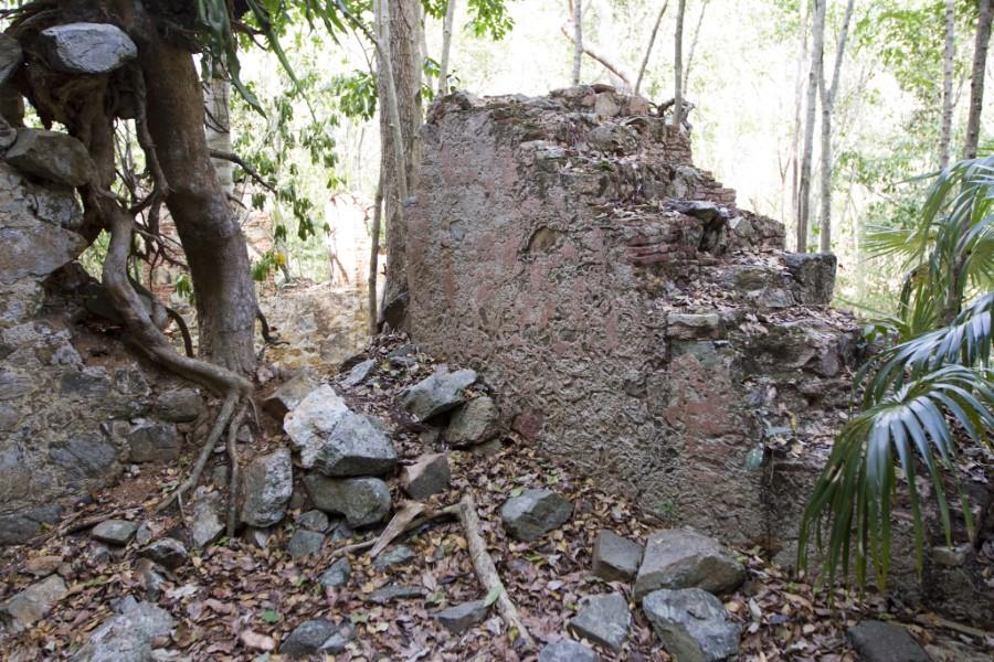
Proceeding to the left, the trail leads to two spur trails. The first spur goes to the Paquerau Ruins and the second to the more extensive Estate Hope ruins, which include the remains of the great house, the horse mill, a cistern, and an animal watering trough.
Continuing south, the trail leads to the Reef Bay Trail just below the Josie Gut Ruins.

History of the Maria Hope Road
Until early in the nineteenth century, people couldn’t travel all the way from east to west on what was then called Konge Vey (King’s Road) and which is now known as Centerline Rd or Route 10. The road was divided in two by a gorge located at the saddle of the Maho Bay Valley on the north and the Reef Bay Valley on the south. This gorge was known as the defile and was impassable by donkey cart or horseback.
When travelers on horseback or wagon going between the Coral Bay side of St. John and the Cruz Bay side came to the defile, they had two options:
Option 1: There were corrals for horses on both sides of the defile. They could leave their horses in the corral on one side, cross the defile on foot and arrange to take another horse to continue east.
Option 2: They could take the Maria Hope Road down the Maho Bay Valley to the north and continue east on the north shore.
Around the year 1780, the defile was filled in by the owner of the Old Works Estate, Peter Wood, and the two sides of the island were connected by one road for the first time.
When Centerline Road was constructed along the mountain ridge, hundreds of tons of fill were brought in to make the road passable by motor vehicle. In the process, the Old Works Estate and the uppermost section of the Maria Hope Road were completely covered over, with the exception of the horse mill wall, which can be seen as soon as you descend the stairs to the Reef Bay Trail.
The ruins of Maria Hope Estate lie just about 200 feet from Centerline Road at the trail entrance to the Maria Hope Trail. Access to the ruins is provided by a trail going east and up just as you enter the Maria Hope Trailhead.
Ownership of the Valley
Most of the valley is currently owned by a complicated association of National Park and private interests. There had been talking about the possibility of development, but it now appears that the valley will become the property of a land trust and eventually will be turned over to the National Park. The valley is a beautiful example of a natural St. John forest.
