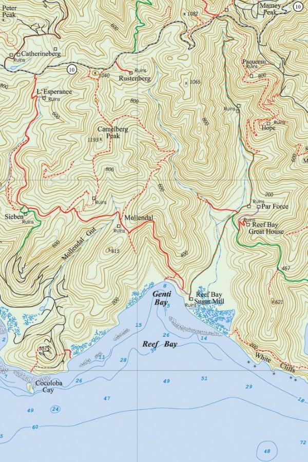
The L’Esperance Trail runs between Centerline Road and Reef Bay. The top of the trail can be found at a point about 0.3 miles east of Cathrineberg Road. The foundation of an old house can be seen at the beginning of the road. Park here if you arrive by vehicle.
From the Centerline Road intersection, the L’Esperance Road descends the western side of the Fish Bay Valley in a moist forest environment where you will pass through stands of genip, guava berry, turpentine, bay rum, and mango trees.
L’Esperance Ruins
A ten-minute downhill walk takes you to a spur trail leading to the L’Esperance Ruins. The remains of a beautiful stone bridge cross the Fish Bay Gut.
The presence of the gut was what made the estate viable. A spring near the water works was able to provide at least some water even on extremely dry years.
The old estate contains the ruins of the original horse mill, a storage building, an estate house, and a sugar factory. The residence had a gallery on the lower level. The upper story, which was of wood frame construction, also had a gallery.

The cookhouse is nearby, as is the cook bench. Beyond that is a structure that probably housed the overseer, and beyond that is the remains of a Dutch oven.
There are two horse mills. One is located below the greathouse and is mostly in its original configuration. The stone retaining wall on the lower side is still intact. The other horse mill is located across the trail as you come in.
This horse mill was apparently abandoned when the new one was constructed. A slave village was located below the horse mill where at one time, there were 16 slave houses. The sugar factory building can be found below the estate house.
Off to the right of the factory is the rum still with its cistern for cooling the distilled mash. The house where the rum was bottled is adjacent to the rum still and cistern.
The grave found at L’Esperance belongs to Heinrich Tonis, the great-grandson of the original owners of Estate L’Esperance, Claus Tonis. He was a wealthy Dutch merchant who first took up the plantation in conjunction with the Governor of the Danish West Indies, Eric Bredal. This is one of the oldest marked graves on St. John.
A royal palm tree is visible from the trail near the estate house, which may be a remaining native species. There is some dispute as to whether the royal palm is native to St. John or whether it was brought in.
One theory is that the royal palm, which has an edible heart of palm, was harvested by Tainos living on St. John. Because the tree is killed in this process, the species may have been almost completely wiped out over the centuries.
From L’Esperance Trail to Seiban Trail
Leaving L’Esperance and continuing the hike, the road follows the Fish Bay Gut, and the environment gets moister and denser in an environment of large mango, genip, guava berry, and kapok trees.
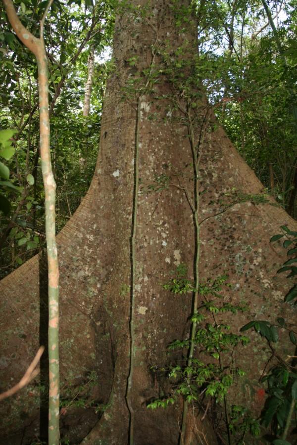
The road crosses the Fish Bay Gut, and if you’re taking this route to Fish Bay, it’s a convenient place to access the gut. The road turns east at the gut, and you can pass through an area dominated by bromeliads, penguins, and anthuriums.
As the trail winds around to a southern exposure, the environment becomes drier, and the flora changes dramatically from forest to scrub. There was once a cattle operation here, and you can still see the sections of an old barbed wire fence.
Wild tamarind, thorny cassia trees, catch-and-keep and maran bush became the dominant species of plants because almost everything else was eaten by the cattle. The land has not recovered appreciably, although it has been more than 60 years since the last cattle were raised here.
The first path off to the right leads to the ruins of the old Seiban Estate. The plantation covered more than 150 acres. The extensive ruins include the remains of the sugar factory, rum still, estate house, and various other structures. In addition to sugar, Estate Seiban was one of the few estates to grow coffee.
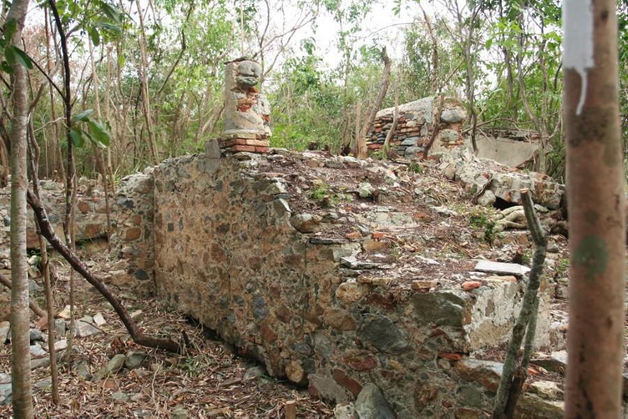
There were reported to be two canons here at one time, with one supposedly still remaining somewhere in the thick bush.
The canons were probably placed at Seiban when the governor and commandant of St. Thomas and St. John became the owner of the estate through marriage, and it became the St. John Governors’ residence. An old drill press lies by the side of the trail.
The only baobab tree on St. John can be found here in Estate Seiban.
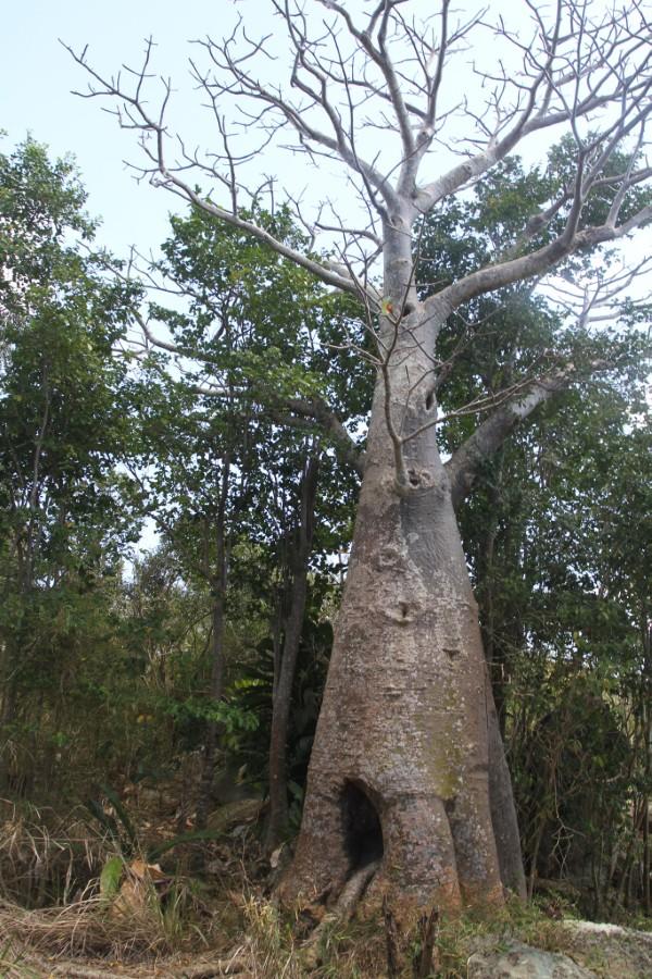
In many parts of Africa, the baobab tree is thought to be sacred and magical. The first seeds from these trees were brought to the Caribbean by enslaved Africans. Although there is only one baobab on St. John, St. Croix has more baobab trees than any other island in the Caribbean. Great views of Fish Bay and the south shore of St. John can be had from behind the tree.
An old Danish Road, the Great Seiban, connects Seiban to Fish Bay. The trail descends from the Seiban Ruins near the baobab tree and follows the contour of the Fish Bay Valley, leading to a residential area of Fish Bay.
From Seiban to Mollendahl
The main road crosses another ridge and once again begins to descend the valley. On the south side of the road, there is a cut for a property line marked with flags that can be used as a path. There is a cemetery there with above-ground graves and cottages with galvanized roofs dating from when people lived there in the early part of the century.
Soon after this, you come to an overlook with views of the Fish Bay Valley, the Ditleff Point Peninsula, and on a clear day, the island of St. Croix.
The road winds down to a beautiful bay rum stand that is growing alongside the gut that flows down to the eastern part of Fish Bay. Alongside the gut is a man-made wall and a fence. If you were to follow this down, you will reach Fish Bay Road in the vicinity of Guavaberry Farms Nursery.
Up the gut and to the west are the remains of an old shingle-walled house that was occupied until the 1950s. At that time, most of the houses in Cruz Bay were of similar construction.
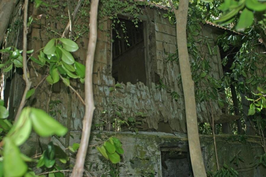
Next to the house are the remains of a cookhouse, a well, an oven, and an old boiling copper. Look for bats on the ceiling, some of which may be nursing their young.
From the Eastern Fish Bay Gut to Mollendahl
The L’Esperance Road continues along the eastern ridge of the Fish Bay Valley. After passing a turnaround area for vehicles, the road turns right, crossing the mountain ridge bringing you into Reef Bay.
The improved section of the road ends shortly after the right turn but continues as a footpath. There is an overlook with views of the Reef Bay Valley near the top of the path.
Between the bay rum gut and the turnaround is the entrance to the Mollendahl Ruins. Some 50 yards further along the trail, you come to another old house with a flat galvanized roof, which is now in a collapsed condition due to the effects of Hurricane Hugo in 1989.
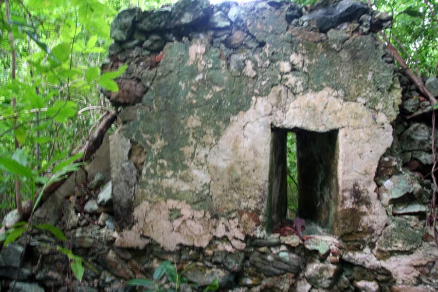
Estate Mollendahl can be reached by a barely recognizable trail on the west side of the road, which can be found after you pass the gut and bay rum grove, but before the large genip tree and the collapsed house.
The ruins include a sugar factory, rum still, horse mill, and various other structures. The boiling house had about four coppers for boiling the cane juice. The horse mill lies above the factory, with the lower part supported by a stone retaining wall.
The flat area immediately before the boiling bench held the lead-lined box called the receiver, which collected the cane juice and regulated the flow of juice to the coppers by means of a spout. The holes in the wall are vent holes used to regulate the heat.
On the outside of the wall was the firing trench where fires were built under the coppers to boil the cane juice. The structure is rectangular, which indicates that it predates the T-shaped sugar factories like the Annaberg Plantation, which was built between 1780 and 1820. The first factories were all rectangular. The rum still and the storage house ruins can also be found nearby.
The estate was equipped with cannons, some of which still remain.
From Mollendahl to the Reef Bay Valley Floor
Continuing down the trail, you will notice how this road was stabilized by a stone retaining wall on the lower side. Along the way down, there are excellent views of the Reef Bay Valley and the shoreline.
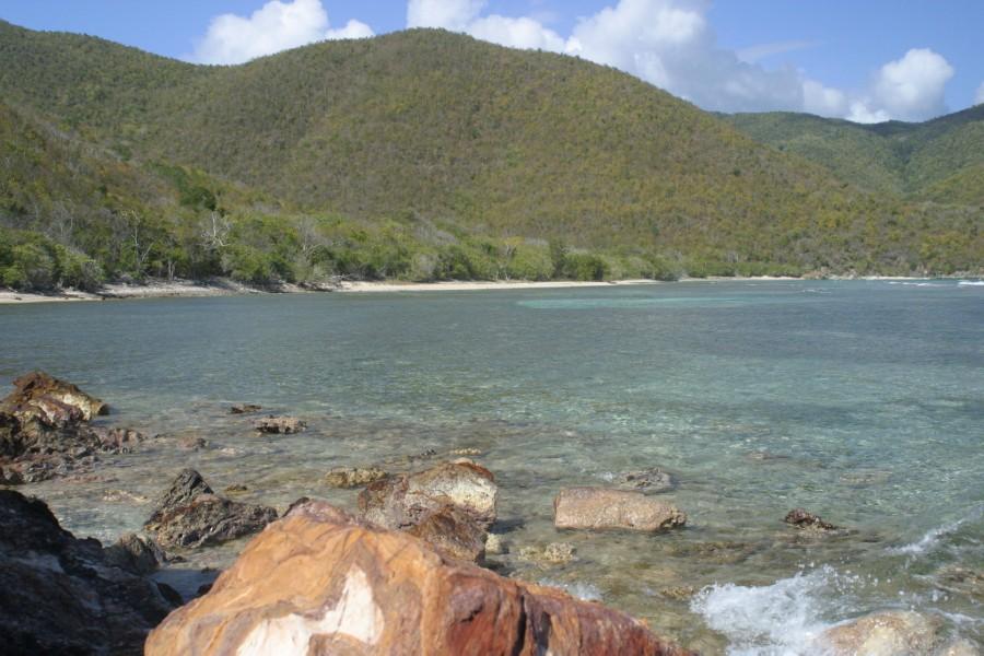
The trail continues to lead down into the valley, and as you approach the bottom, there is a short spur that descends to the right and leads to the beach. The main trail continues, leading to the trail which crosses the rocky headland between Little Reef Bay and Genti Bay.
The Reef Bay Sugar Mill Ruins will be to the east or to your left, and the beach at Little Reef Bay will be to your right,
L’Esperance Road History
The L’Esperance Road dates back to Danish colonial times and runs from Konge Vey, now Centerline Road, to the Reef Bay shoreline. The road provided access to L’Esperance, Seiban, and Mollendahl Estates and a means for the plantations along the route to ship their products via ox carts to Reef Bay, where they could be loaded onto sailing vessels for export.
Until the 1780s, Konge Vey did not connect Cruz Bay to Coral Bay because of a deep fissure or rift in the island at the saddle between the two hillsides where the Reef Bay Trail is now located. Called “the Defile,” this fissure was so steep that it was impossible to ride across it on horseback, let alone by donkey or ox cart. Because it could not be crossed, roads led from the two sides of the defile down to both the north and south shores.
During the 1780s, work began on a bridge over the defile. The tall stone retaining wall of that bridge can still be seen on the north side of Centerline Road across from the entrance to the Reef Bay Trail. With the construction of the bridge, travel between Cruz Bay and Coral Bay could be made directly on the King’s Road, and the roads leading down the mountainsides became less important as thoroughfares.
The L’Esperance Road, however, was still well-used as it was the road to multiple places. If one was coming from Cruz Bay, it was the road to Reef Bay, Little Reef Bay, Par Force, Lameshur, and John‘s Folly.
The L’Esperance Road was passable by four-wheel drive vehicles until the 1950s when it started to grow over. Some of the owners of the inholdings (the term used to designate private property located within the National Park boundaries) paid to have the road bulldozed in the 1970s, and it remained in good condition until 1995 when Hurricane Marilyn closed off the road with fallen trees.
It became covered with catch-and-keep and other vines and vegetation. Through the efforts of the Trail Bandit and local hikers, the road was cleared and again passable all the way to the Reef Bay Trail.
The L’Esperance Trail was improved in 2007 by volunteers from the Student Conservation Association and was designated an official National Park Service trail that same year.
