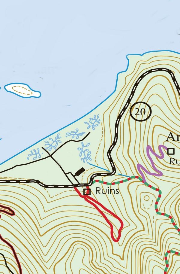
There are two common cinnamon bay trails, the normal one, simply referred to as the Cinnamon Bay Trail and the looping trail. We included a map of each down below to avoid any confusion.
First well, cover the looping trail. If you only have enough time on St. John to hike one trail, then the Cinnamon Bay Self-Guiding Looping Trail is the trail for you. The trail is relatively short, flat, and shady.
This means it’s a perfect choice for those who would like to experience a taste of the St. John interior but who might be put off by the prospect of a long hike on the often hilly and rugged terrain characteristic of the St. John forest.
As an added bonus, the Virgin Islands National Park has placed a series of wonderfully informative signs along the trail covering everything from history and culture to nature and environmental concerns.
Cinnamon Bay Looping Trail
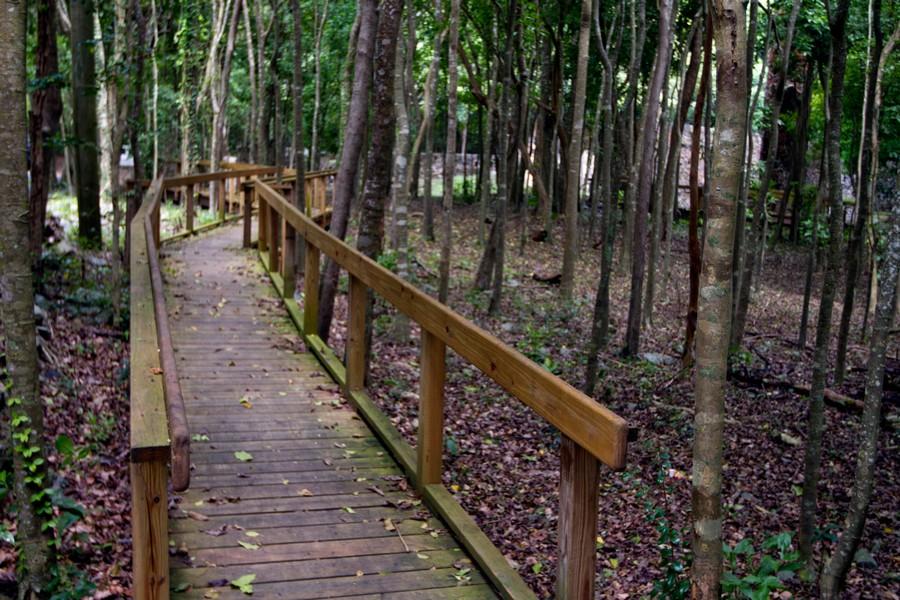
Concrete pathways and boardwalks installed ten years ago now make most of the Cinnamon Bay Self-Guiding Trail wheelchair friendly.
The one-half-mile Cinnamon Bay Trail begins on the North Shore Road about ten yards east of the Cinnamon Bay Beach and Campground entrance on the opposite side of the road and will lead you through the remains of an old sugar mill and bay rum factory.
From there, the trail circles through the surrounding forest and emerges back at North Shore Road, where you can observe the remains of the old estate house.
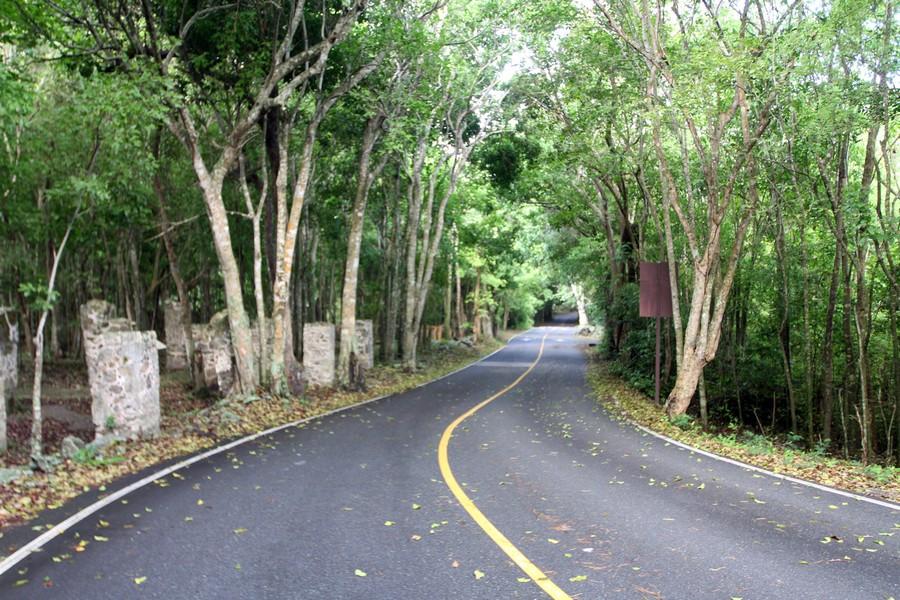
The twelve columns that at one time supported the factory storage room are plainly visible from the road. This stone structure was used for the storage of crude brown sugar called muscovado, molasses, barrels of rum, and crushed and dried sugarcane stalks called bagasse, which was used for fuel and fertilizer.
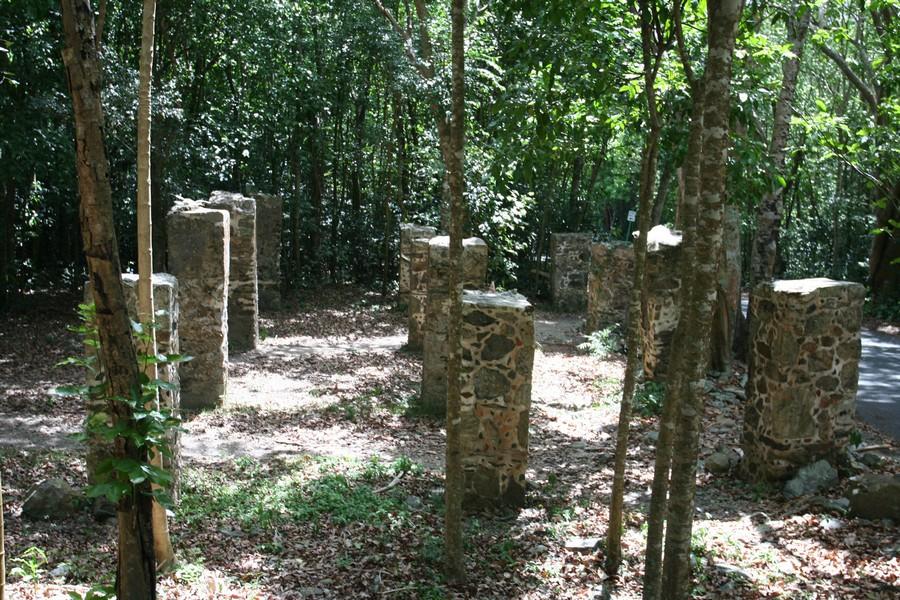
South of the storage room is the remains of the horse mill and the boiling house. The sugarcane crushing apparatus was in the center of the horse mill, and from there, the cane juice flowed down the trough and into the boiling room.
On the west side of the boiling room were the boiling trays where the cane juice was boiled down, transferred from copper pot to copper pot, and gradually thickened into sugar. The fires were stoked from the outside of the building. The large chimney still remains.
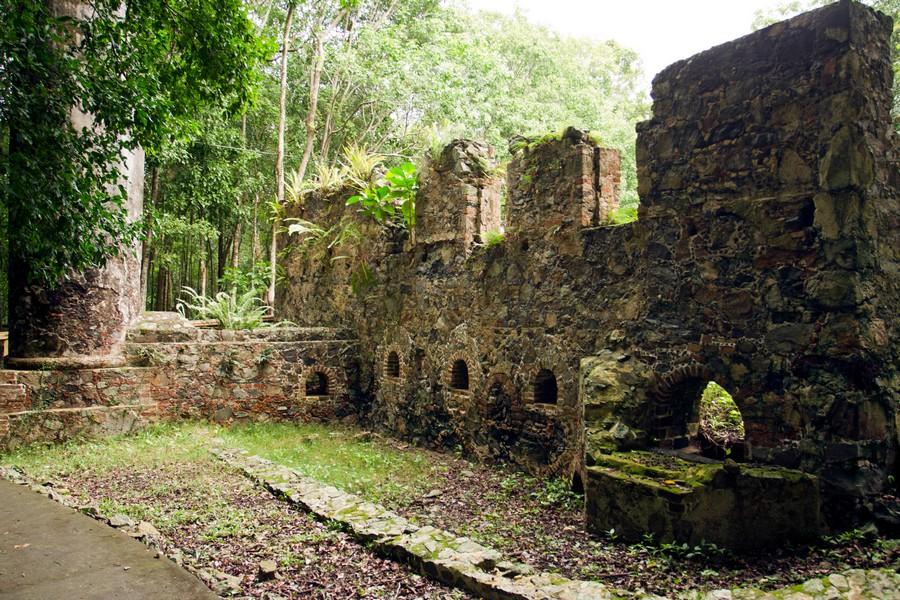
On the southwest corner of the sugar factory is the well-preserved bay rum distillery. The Danish West India Plantation Company acquired Cinnamon Bay at the turn of the twentieth century.
In 1903, they began growing fruit and bay rum trees for the production of the bay leaf oil, used in the popular cologne and lotion known as St. John Bay Rum. Fruit cultivation did not turn out to be economically rewarding because of the difficulty in transporting the fruit to the European market. The fruits would often spoil before they could be sold.
Bay rum oil, on the other hand, showed some promise. It did not deteriorate rapidly and had the potential to be a profitable commodity. The success of this venture at Cinnamon Bay motivated other landowners on St. John to begin bay rum production. Harvesting bay rum leaves was a labor-intensive process.
Workers, who were often young children, had to climb the trees and carefully strip off the leaves. All the leaves could not be picked off the tree at one time, and neither could the leaves be picked more than twice a year to avoid damage to the tree. The leaves were put into large sacks and brought to the distillery.
From the bay rum distillery, the trail leads into the tropical forest and a magnificent stand of bay rum trees. A short spur trail to the left leads to an old Danish cemetery.
After about a quarter mile, the trail crosses the gut. In this area, you may notice several extremely large dead trees, some still standing and others that have already fallen.
These trees were mammee apple trees. As late as the early 1980s, these magnificent trees lined the Cinnamon Bay portion of the North Shore Road and grew in abundance in the forest near the gut.
The die-off may have been caused by a depletion of the underground water table in the 1980s when an unusual amount of water was taken from the wells.
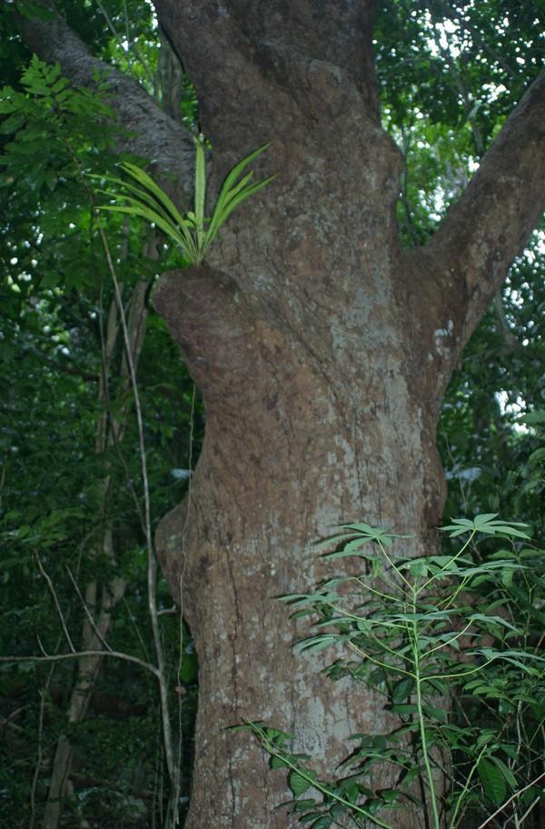
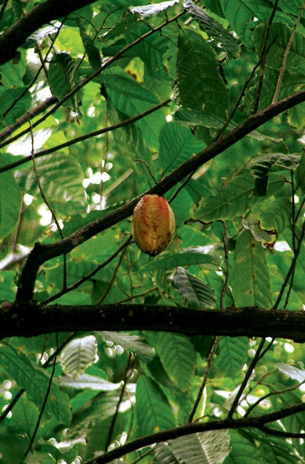
A short distance after crossing the gut, the trail leads back in the opposite direction. The gut will now be on your right. Here is a small stand of cocoa trees, which grow a seedpod from which chocolate is derived. The cacao tree, Theobroma cacao, is a native of the Americas.
The brown pods that protrude from the trunk and branches of the tree contain the seeds from which chocolate is made. The Cacao trees found growing alongside the Cinnamon Bay Loop Trail may be the only ones on the island.
Continuing along the trail, you will pass several large mango trees, which are hundreds of years old.
These and other fruit trees were usually left standing when fields were cleared first for sugarcane production and later for cattle grazing and charcoal manufacture, and thus are some of the largest trees found on the island.
On this side of the gut, look for the many guavaberry trees, which can be identified by their smooth, shiny bark that looks much like the bay rum tree, but with smaller leaves.
The trail leads back to the estate house area of the plantation, and here you will find an excellent specimen of the distinctive calabash tree. The fruit of this tree, although not edible, is used to make bowls, purses, and other handy items.
The estate house is directly west of the sugar factory. In the early 1900s, it was demolished by a hurricane. The house was rebuilt with the walls and roof made out of galvanized steel. The caretaker of the property lived here until the summer of 1969.
Cinnamon Bay Trail
In the plantation days, there was a road that ran along the north shore of St. John between Brown Bay and what is now called Cinnamon Bay.
To reach Cruz Bay from the north shore bays, such as Cinnamon, Trunk, Hawksnest, Denis, and Caneel, it was necessary to first go up the mountain to Centerline Road (called Konge Vey at that time) and then head west from there.
Most of these mountain routes were no more than horse or donkey trails. They generally followed the natural drainage guts in the mountain valleys. In areas where no trails had been cleared, the gut itself served as the path. The trail at Cinnamon Bay follows one of these Danish roads, which in the old days provided Cinnamon Bay with access to Konge Vey.
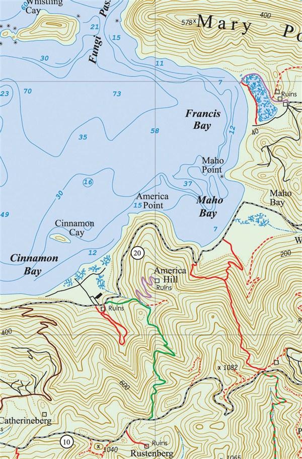
The Cinnamon Bay Trail connects Cinnamon Bay with Centerline Road. It begins about 100 feet east of the entrance to the Cinnamon Bay Campground on North Shore Road, just past the ruins, which are visible on the side of the road. This trail is 1.2 miles long and ascends steeply, gaining about 700 feet in elevation.
The beginning of the trail is the most difficult part, so don’t be discouraged by the steepness and lack of shade. There is a conveniently placed flat rock near the top of the first steep ascent on the right side of the trail that can provide comfortable seating for two and maybe a welcome rest stop.
The trail soon levels off and crosses a gut. At this point, you will find yourself in a relatively cool and shady forest. From here on, the ascent will be easier and shadier.
Waterfalls cascade down the Cinnamon Bay Gut after heavy rain.
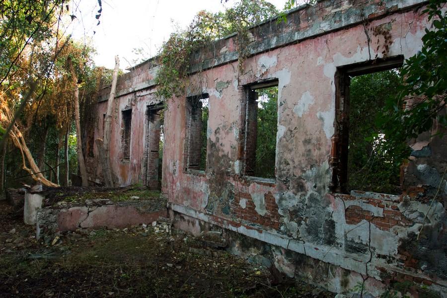
The America Hill Trail begins about 50 yards past the first gut crossing, marked by a steel post, and leads to the ruins of the Estate House at America Hill. These ruins can be seen from Maho Bay, on the hill to the west.
The trail to the estate house runs uphill and switches back five times before you reach the mountain plateau upon which the greathouse ruins lie.
Do not climb on or go too close to the ruins, as they are unstable.
The America Hill Estate House is an excellent example of late nineteenth-century Virgin Island architecture. Much attention was obviously given to an aesthetically pleasing design as well as to functionality, the limitations of the building site, and the availability of materials and labor.
In the early 1900s, America Hill served as a guesthouse where travelers could rent rooms. One of the last tenants was rumored to be Rafael Leónides Trujillo, former dictator of the Dominican Republic.
Some older St. Johnians say that the estate house was also used as a headquarters for rum runners during the prohibition days.
As was the custom in those days, the cookhouse, or kitchen, was built as a separate structure. The remains of the cookhouse are to the right of the main building. The date 1934 is inscribed on the cooking bench. To the left of the estate house ruins are the remnants of a cistern and a well.
Thanks to the efforts of Friends of the Park trail volunteers, the views from the estate house are once again spectacular, particularly if looking to the west.
Continue up along the Cinnamon Bay Trail, keeping the gut on your right. The forest is shady and cool, with light filtering through the trees. The hillside is covered with bay rum trees, and the fragrance of their aromatic leaves permeates the forest.
When you come to a fork in the trail, bear right. The other path soon ends in the bush.
During the sugar plantation days, most of this area was cleared and terraced by an enslaved labor force. The remains of these stone terraces are visible on the hillside above the trail.
Strategically placed along the trail are lines of rocks crossing at an angle. These serve to divert the flow of water across the trail and prevent erosion that would result from water flowing freely down the length of the trail. Some of these rudimentary culverts have existed since the Danish days. This innovative management of the water runoff has kept many of the old Danish roads in fairly good condition.
You will start to see a lot of wild anthuriums growing near the trail. Off to the left, or upper side of the trail, try and find a fairly well-preserved terrace retained by a wall of dry stacked stones. In this area are the remains of a large hole where the earth appears to be black in places. This was once a charcoal pit.
After a series of switchbacks to gain elevation, the trail again crosses a gut. In this area, you can find hog plum fruit when they are in season. The problem is that the hog plums are invariably too high to pick off the tree. Worms, birds, and insects are usually quicker than hikers to find the ripe fruit that falls to the ground.
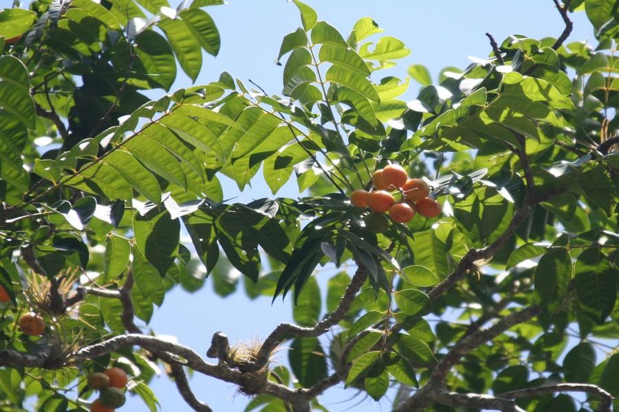
After another series of switchbacks, you will come to an area of tall beautiful trees, such as West Indian locust, kapok, and genip.
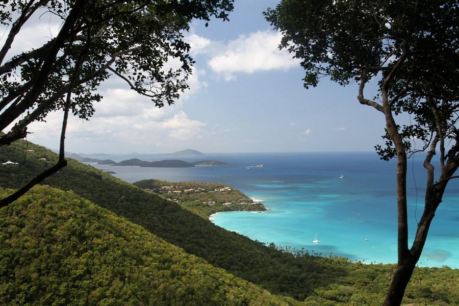
Jeff Chabot, group leader, and volunteers working with the Appalachian Mountain Club in a cooperative venture with the Virgin Islands National Park and Friends of the Virgin Islands National Park cleared a new overlook along the trail, with views extending from Jost Van Dyke to St. Thomas and the northwestern cays.
This beautiful overlook replaces an older one higher up on the trail near the top, which has long since been overgrown.
The path turns to the right and then continues upward through the forest, emerging from the bush at Centerline Road. From here, you can turn around and make the easier downhill hike back to Cinnamon. Other alternatives to return to the campground are the Maria Hope Trail to the east or the Cathrineberg Road to the west.
